
Geology.com posted interactive maps showing results for escalating sea level rises for Florida, New York/New Jersey, New Orleans/Gulf Coast, Washington DC, the Nile Delta, the Netherlands, Venice and San Francisco, Bay Area, Sacramento Valley.
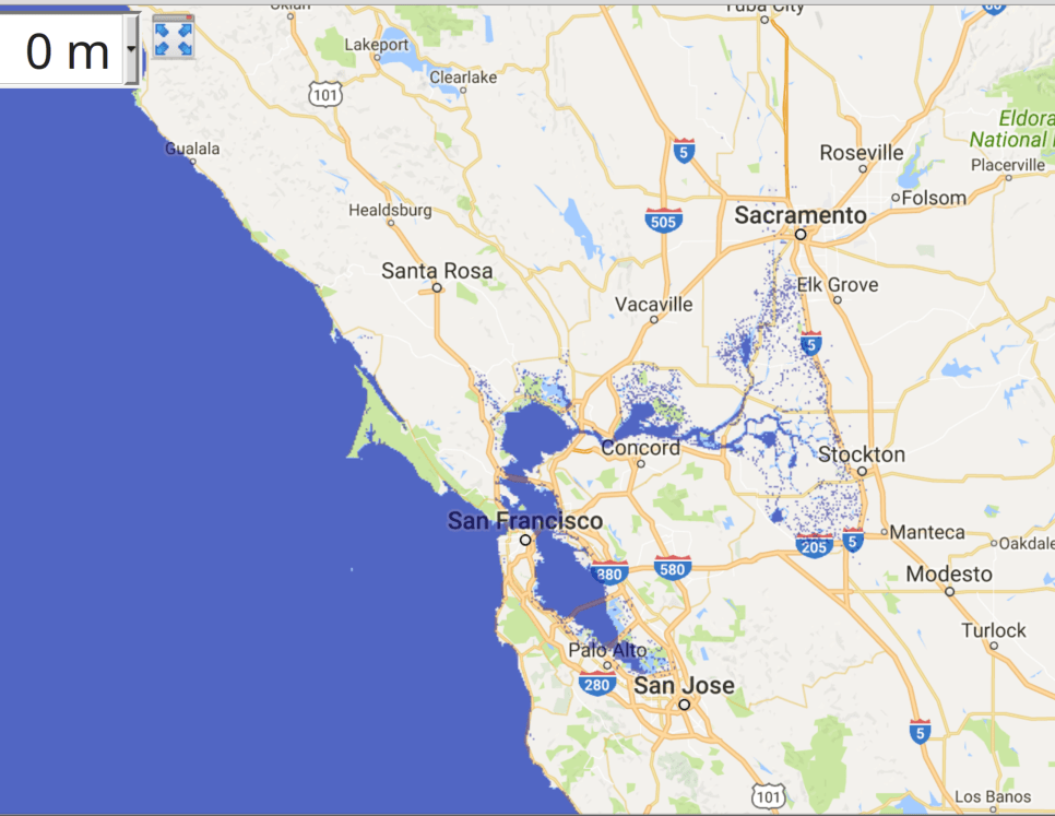
Here’s the present level, with projections for 1, 2, 3, 4, 5 and 60 meters following, for you soggy-bottom property owners who might have to relocate-unless you believe our President-Elect, the grifter Pussy-Grabber-in-Chief, that global warming and sea level rise are a hoax. God help us all.
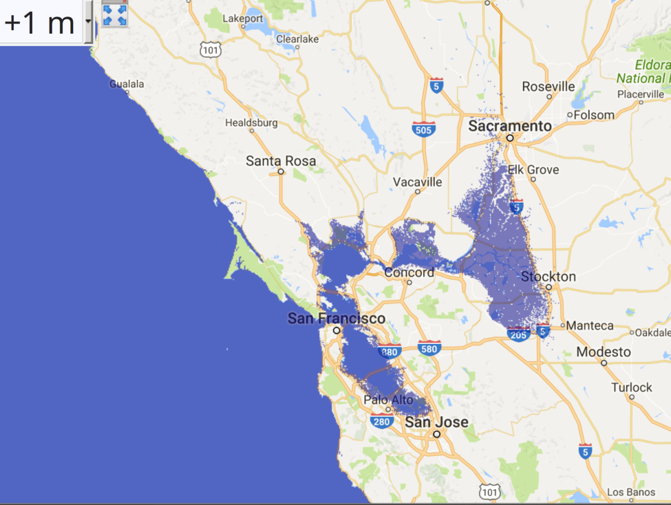
Even at one meter (3.3 feet) California’s Delta, the heart and lungs of California, are flooded. See it while you can.
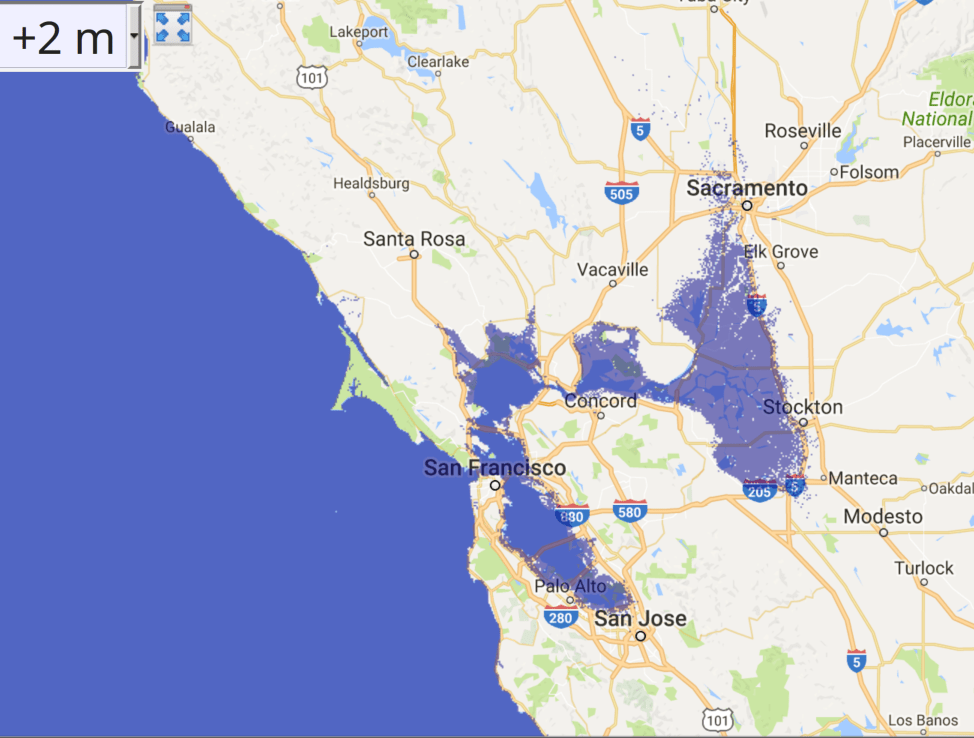
Two meters (6.5 feet), there goes the Marina District and Interstate 5.
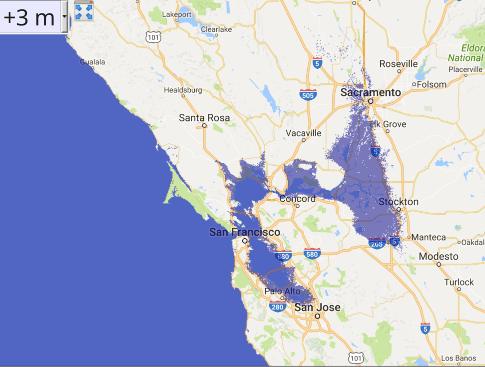
Three meters (9.8 feet), Silicon Valley and West Sacramento get wet, Stockton gets worried.
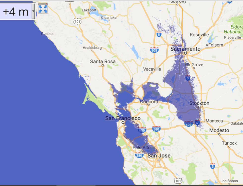
Four meters (13 feet).
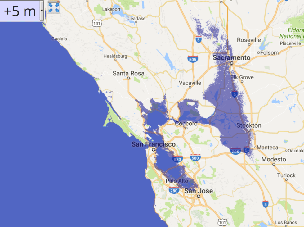
Five meters (16.4 feet). The Great Valley is becoming the Great Lake.
Finally, here’s 60 meters (197 feet) of sea level rise, achieved on many occasions during geological times.
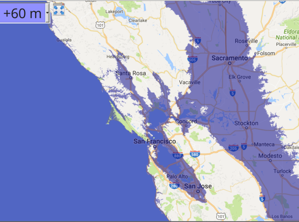
Much of SF and the East Bay, and all the Central Valley, plus many low-lying square miles elsewhere are now in Davey Jones’s locker including, sadly, my town of Roseville. On the upside, boating opportunities expand so we’ve got that going for us.
Unless noted, all text and images produced by todgermanica.com. Noncommercial use free with attribution.
